The Southern Heart — A Journey Through the South Island
There is a moment, somewhere over the Pacific, when you look out the window and see the first peaks of the Southern Alps breaking through the cloud. They do not look real. They look like something drawn — an impossibly jagged line of white and grey against a blue that deepens as the plane descends. That is your first glimpse of the South Island, and it is enough to make you forget how long you have been in the air.
Wild Interior·5 min read·
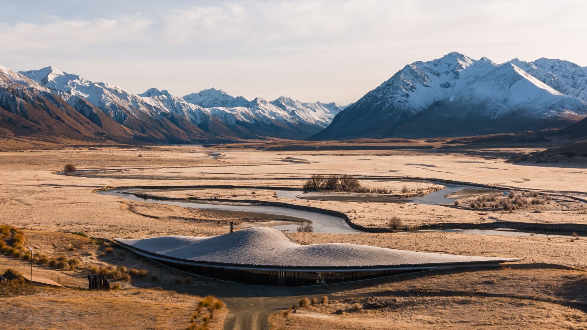
The Southern Heart
Before you arrive
There is a moment, somewhere over the Pacific, when you look out the window and see the first peaks of the Southern Alps breaking through the cloud. They do not look real. They look like something drawn — an impossibly jagged line of white and grey against a blue that deepens as the plane descends. That is your first glimpse of the South Island, and it is enough to make you forget how long you have been in the air.
What you do not know yet is that the mountains are only the beginning. Over the next fourteen days, you will move through landscapes that change so completely, so abruptly, that you will stop asking how far it is to the next destination and start hoping it takes a little longer.
Kaikōura: where the mountains meet the sea
Kaikōura does something to your sense of scale. The town is small — a few streets tucked between the Pacific and the Seaward Kaikōura Range — but the setting is vast. Mountains rise directly from the ocean here. Snow-covered peaks frame the coastline. And beneath the surface of the water, a deep submarine canyon brings sperm whales within sight of the shore.
You board a boat in the morning. The air is cold and clean. Within twenty minutes, you are watching a sperm whale exhale a column of spray into the sunlight, its fluke rising as it sounds. Dusky dolphins arc alongside the boat. Fur seals haul themselves onto rocks with the resigned air of creatures who have been doing this for millennia and will be doing it long after you have gone home.
This is not a zoo. There is no guarantee. The whales decide whether they want to be seen, and some days they do not. But on the days they do, the experience recalibrates something in you — a quiet understanding of how small you are, and how extraordinary it is to be here at all.
The rhythm of the road
From Kaikōura, the journey unrolls in a sequence that has its own internal logic. North to Marlborough, where the sauvignon blanc is world-famous and the green-lipped mussels, steamed open on a boat in the Sounds, taste of salt and clean water. Through Nelson, the sunniest corner of the country, where the beaches are golden and the arts community has made something quietly remarkable in a town that feels like it has all the time in the world.
Then west — across to the wild coast, where the bush is dense and prehistoric, where the Pancake Rocks at Punakaiki erupt with blowholes at high tide, and where the road hugs the coastline so tightly you can taste the spray.
Franz Josef: walking on a river of ice
The helicopter lifts off from Franz Josef township and within seconds you are climbing. The rainforest falls away. The glacier appears — a frozen river spilling down from the peaks, blue where the light catches it, white where the snow lies fresh.
You land on the ice. The guide fits crampons to your boots. And then you walk — not on a marked trail, but on the glacier itself, stepping over crevasses, ducking into ice caves, touching surfaces that have not seen sunlight in centuries. The sound of the glacier is a low creak, a settling, a reminder that it is moving even as you stand on it.
This is not something you photograph well. The scale defeats the lens. But you remember it — the cold, the blue, the sense of standing on something ancient and alive — long after you have left.
Central Otago and the lakes
The drive south from the West Coast takes you through Haast Pass and into a different New Zealand. The rainforest gives way to tussock. The humidity drops. The sky opens up. You are in Central Otago now — the driest, most continental part of the country, where the light is golden and the air is thin and the pinot noir is extraordinary.
At Lake Wānaka, the water is so still in the morning that the mountains are reflected perfectly, doubled. You stop at Rippon Estate, on the lake's edge, and taste wine made from grapes grown in sight of the water you are looking at. The connection between what is in the glass and what is in front of you is immediate and complete.
From Wānaka, the road climbs through the Crown Range to Queenstown. This is the highest sealed road in the country, and the moment you crest the pass and see Lake Wakatipu stretching below you — the Remarkables rising on the far side, the town tucked into the shoreline — is one of those moments that makes fourteen hours in the air seem like a very small price to pay.
Aoraki: under the dark sky
Near the end of the journey, you arrive at Aoraki / Mount Cook. The mountain — New Zealand's highest — rises 3,724 metres above the valley floor. In the morning, you walk the Hooker Valley Track, a gentle three-hour return that takes you across swing bridges and through tussock to a glacial lake at the foot of the mountain. Icebergs float in the terminal lake, even in summer.
That night, you stand outside in the dark. The Mackenzie Basin is an International Dark Sky Reserve — one of the largest in the world. There is no light pollution here. The Milky Way is so bright it casts a shadow. You stand there, neck craned, cold air on your face, and you understand why the early Māori navigators read the stars as maps. There is more information in this sky than you have ever had the stillness to receive.
What stays with you
The South Island does not offer itself up all at once. It reveals itself gradually — through the sound of waves at Kaikōura, the taste of a freshly shucked oyster in the Marlborough Sounds, the cold shock of glacier ice under your fingers, the impossible clarity of a night sky at Aoraki.
By the time you reach the end of the journey, you have not merely seen the South Island. You have felt it. You have walked on it, tasted it, listened to it, lain under its stars. And that is the difference between a trip and a journey. A trip you photograph. A journey you carry.
Written by
The people who compose the journeys. By PPG Tours, New Zealand owned for more than twenty years. How we write
Journeys this piece touches
Add Curated Experiences as a preferred source on Google (opens in a new tab)
More reading
Wild Interior